Day 3 

Yarmouth to Freshwater Bay

9.2 miles


Today was bright and very breezy as we set out from Yarmouth along the sea wall.  The day was cool and we stopped to don our jackets. The path took us into Fort Victoria Country Park and for some time we followed an old military road through the woodland from Fort Victoria to Cliff End Battery.


Yarmouth Harbour

Following the sea wall

Carole makes a friend in Fort Victoria Country Park

Unusual blossom

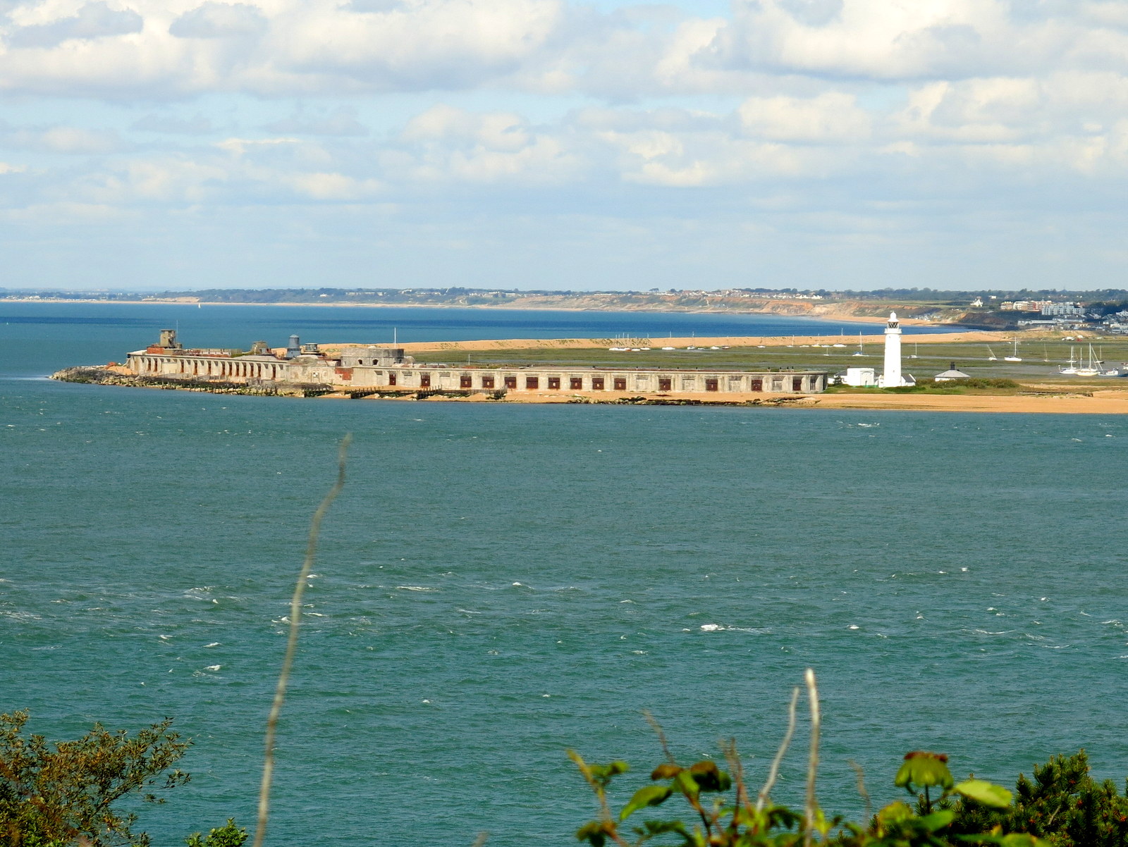
We emerged from the trees to the coast and looking right could see the imposing block of Fort Victoria.  As we walked along we met a local walking his dog and he cheerfully pointed out details of the coast and channels, which he knew from yachting.  Like all Isle of Wight locals we met, he was friendly and helpful and wanted us to enjoy his island.

A little further on we walked down the access road to Brambles Chine Holiday Camp and reached a waterfront cafe where we stopped for coffee and scones, sheltered from the breeze by glass panels.
We then walked along the coast for a while, through Colwell Bay and then along the sea wall to Totland.  

The narrowest part of the Solent

Impressive Fort Victoria
 
Arriving at Brambles Chine Holiday Camp

Hurrying towards a waterfront cafe for coffee at Totland

We now followed a meandering path upwards to the open area of Headon Warren, so called because it used to be a farmed rabbit warren in the middle ages.  We walked over the Warren to the summit of Headon Hill, choosing our path from several overgrown and indistinct paths, until we descended to a main road and turned right to Alum Bay.  All of a sudden we were among dozens of coach tourists and we quickly walked on away from the pleasure park, our path climbing to higher ground where we had a view over to The Needles for the first time and looking back a good view of the cliffs at Alum Bay.  


Sign on Headon Warren


First view of The Needles

The Needles

Alum Bay

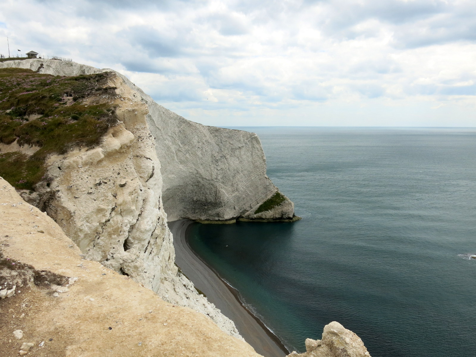
We ascended the white cliffs towards the Needles, across the down and passed some coastguard cottages.  This is a very exposed point and the cottages were protected by tree planting that almost hid them from view on the coastal facing side.  We wandered down to look at the old batteries now managed by the National Trust, then climbed back to look at the new batteries where there was a free exhibition devoted to a secret rocket development project from the '60s.  We enjoyed the exhibition and had another coffee before climbing back to the top of the Down, where a wide green expanse straddles the sea on either side.  

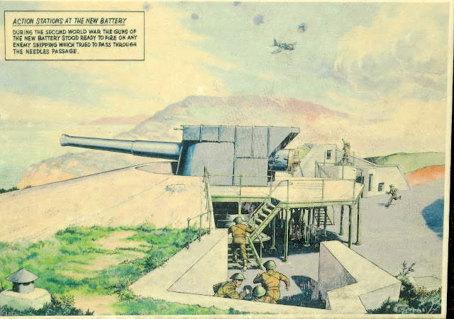
Drawing at the New Battery

How the New Battery looks today

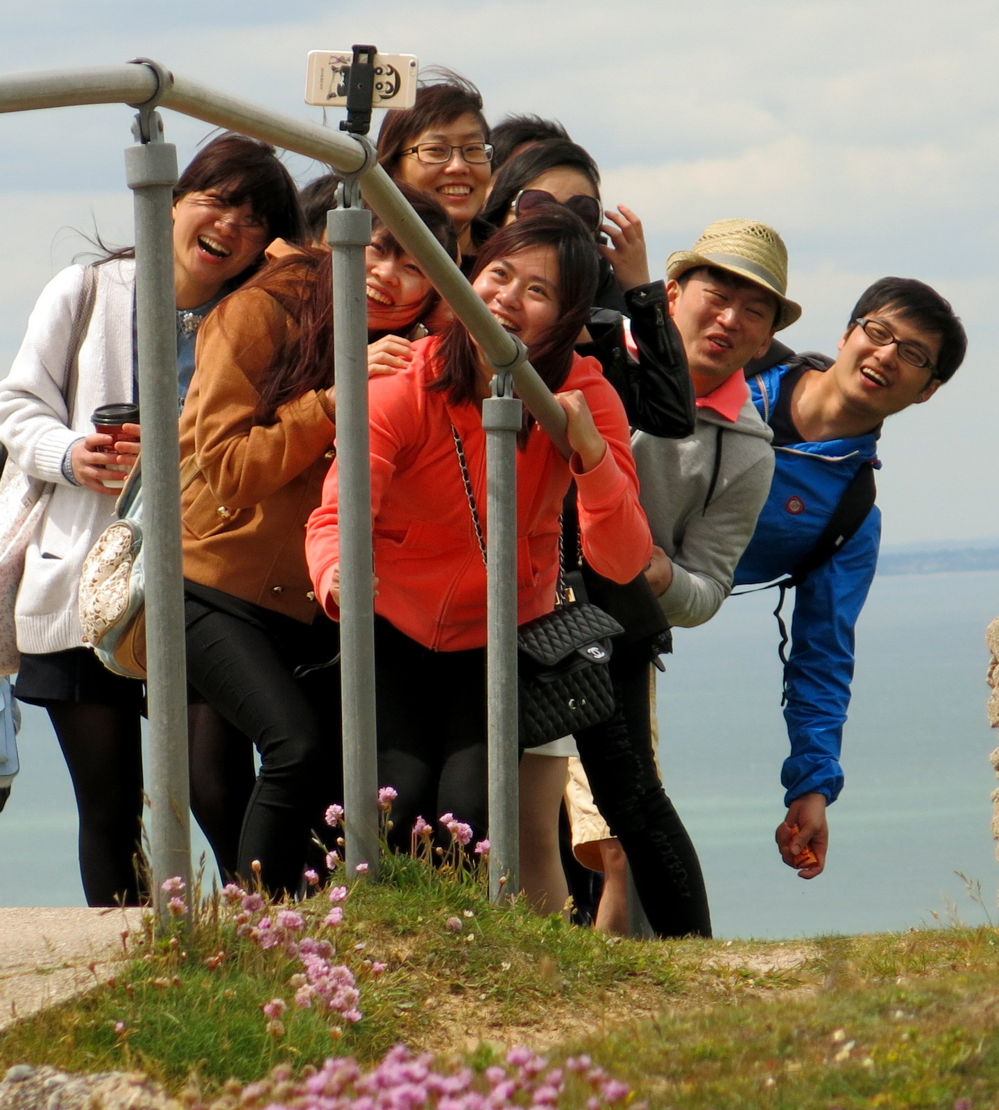
Japanese tourists take a selfie

The Needles from the other side

We walk down for a look around

From The Needles Viewpoint

It was easy to aim for the Tennyson Monument standing out against the skyline, and from here to continue down to our destination, Seahorses Guest House in Freshwater Bay.  As there was limited choice in this area Wight Wanders had kindly booked us into a local pub for our evening meal, The Red Lion, and this proved to be a good choice as we had a good meal in relaxing surroundings.


Carole in front of Tennyson Monument

Nicely worded memorial at the monument

Walking along the down to Freshwater Bay
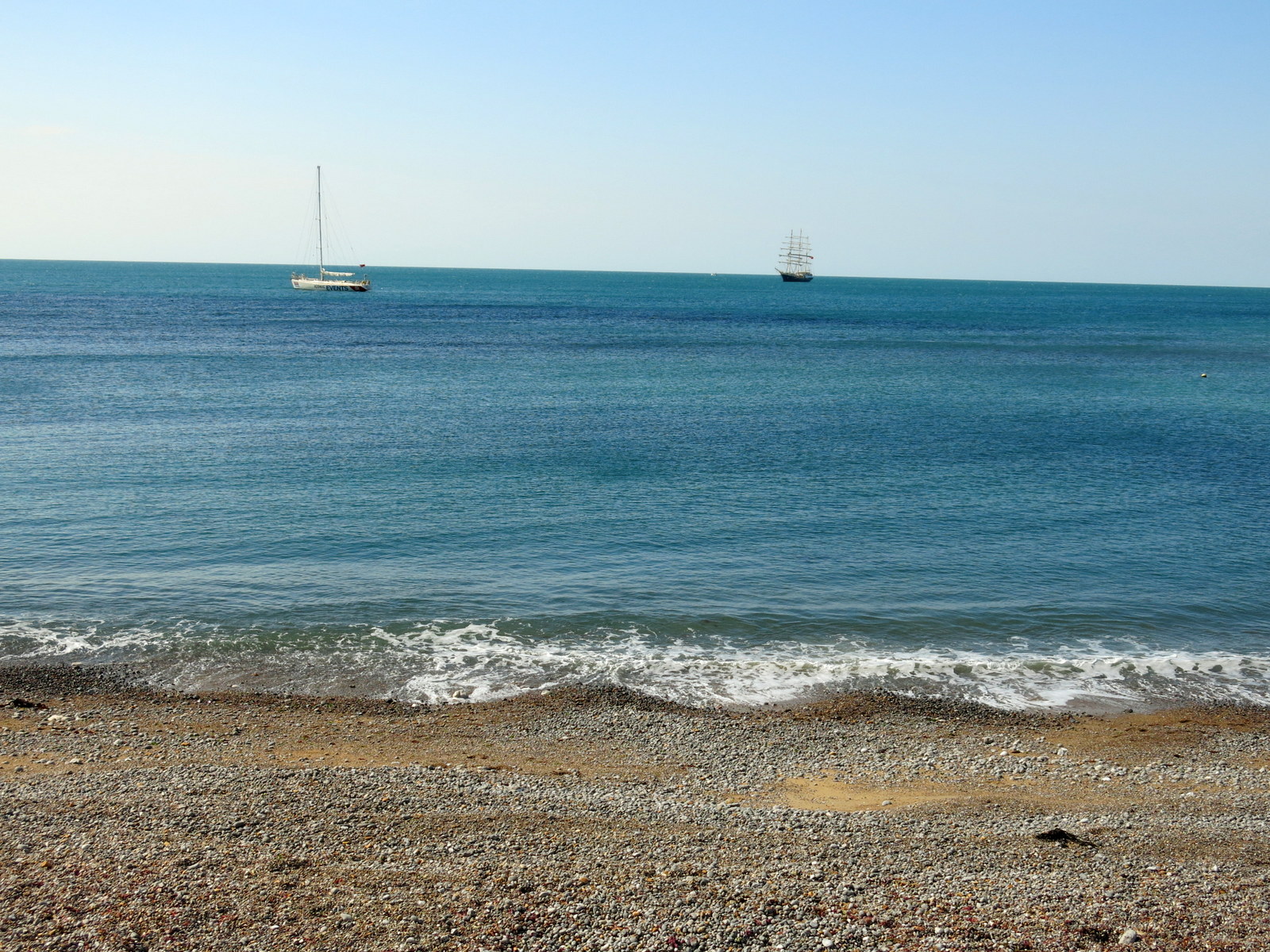
Freshwater Bay

Seahorses, excellent accommodation for the night

Day 4

  Freshwater to Chale

  11.3 miles


Seahorses, our overnight accommodation, provided an excellent breakfast and we were soon heading back towards the Coastal Path.  This could have been called The Cliff Top Path today, as this was where we were, with some minor deviations, for almost the whole of today's walk.

Church at Freshwater Bay

It was still windy with a clear sky and the brightest of sunshine giving a startling sharpness to the landscape; the sea sparkling to our right, golden sands below the cliffs and a bank of rolling green countryside to our left.  We walked across the bay and up the wooden steps at the far end, to the cliff top.  Here our path ran alongside the old Military Road which follows the coast and neatly divides cliffs and seascapes from woods and pasture.

Walking along Freshwater Bay

Early traffic at Freshwater Bay

Looking back at Freshwater Bay from the wooden steps

We reach the cliff tops... and stay there

The cliffs are unstable and although their composition changes from chalk to clay and sandstone as the walk progresses this composition does not bind the coastal margin any more tightly.  Everywhere there is evidence of instability. There are chunks that match the very ground one is walking on that have been torn away and are now metres below the level of the current path.  Sometimes the worn path ends abruptly at a precipice, walkers have created a new one to the left of the old one.  The beaches, often far below, also change as the walk progresses, from delicate pale golds to red tinged sands and are mainly on a grand scale, long sweeps beneath staggering cliffs.  This is the Isle of Wight's Dinosaur Coast and many fossils have been found in these cliffs.  A sign at the car park at Hanover Point had details of such finds.


Looking back towards Freshwater Bay

The cliffs change from chalk to clay


Dinosaurs!

We had to wait until 12 noon for our coffee stop owing to a lack of opportunity.  The first likely place is Wight Pearl, actually a retail outlet for pearl jewellery, just as we have seen in Spain and the Canaries, but incorporating a cafe area.  The kind assistant gave me two scones as he thought they were smaller than they should have been, plus two lots of clotted cream and jam.  Carole had coffee cake and even though I returned for a second mug of coffee I was unable to finish the second pot of clotted cream.


Sea thrift

Our path disappears

They'll have to move the fence further back soon


'Two Scones' and his wife enjoy a break


The next three hours passed in much the same way as the morning had, with us planting our feet carefully on the cliff edge track.  The only interruptions to the path are infrequent 'chines' which are splits in the cliff where the sea pushes inland.  It is necessary to skirt these. 


Cliff top path

A very big drop!

Here you can see the blue 'slipper clay' that slides away taking everything with it

Crossing a chine

Some sort of 'bosun's seat' device to the sea shore


Walking round Whale Chine
 
Finally we walked across fields to our destination, Chale, and were pleased to immediately come upon The Wight Mouse, our overnight stop.  Before claiming our room we sat for an hour in the warm afternoon sun with our beer and an excellent ham and mustard sandwich.  A pleasant end to another pleasant day's walk.


We meet a dog walker near Chale, this dog has had a 'facelift' owing to wrinkles impeding its vision!

Chale and already we arrive at the gates of The Wight Mouse

Our accommodation for the night

But first.... afternoon tea!

Day 5

Chale to Sandown


12.1 miles


The breeze had gone and today was just wall to wall sunshine and much warmer.  Another first rate breakfast, what will these fry-ups be doing to my waistline?  We said goodbye to the Wight Mouse and very quickly lost our way for the one and only time on the Coastal Walk, by turning into Blackgang Chine instead of passing the entrance.  We walked down to the amusements and spent a fruitless half hour trying to find a path that wasn't there.  We persisted because we met another walker doing the same, who was equally sure he was right.  Eventually we made our way out of Blackgang Chine and quickly came across the friendly Coastal Path signs that make this walk stress free. (normally anyway!)


The church at Chale

15 minutes walking and fleeces are off!

We are about to discover we are lost among the pirates

We were soon striding along the Coastal Path above what is called the Undercliff.  I would describe this as a largely flat area of vegetation, well beneath the high cliff we walked on, with occasional but rare groups of houses or cows grazing.  Looking from above they at first appear to be at the edge of the sea but this is an illusion as in fact there is another cliff before the sea.  This feature was very different to the dramatic drops down to rocks and beaches that we experienced yesterday.  Continuing along the cliff top we looked down on St Catherine's Point and its lighthouse.

St Catherine's Point

... sitting on the undercliff


Houses in the 'undercliff'

We are very high at this point
Sometimes there were no views to our right because of hedgerows and sometimes we were grateful because these guarded the edge of the cliff!  We now made our way through field paths and the village of Niton before once more rejoining the cliff top path and reaching the village of St Lawrence.


Just follow the blue signs!

Hedges skirt the cliff top

A sign tells us about the original St Catherine's lighthouse (The Oratory, still standing)


Houses in Niton

The cows are very used to walkers

We followed some steps descending towards St Lawrence and called at the Post Office and General Store to collect a newspaper and toothpaste at 12 noon.  Just in time, as a sign on the shop door said 'Closed at 1pm for new flooring'.  This section of the walk was particularly attractive, first of all St Lawrence itself is a lovely village set on the slopes down to the undercliff and the warmth of the day, the colour of the sky and the sea gave it a Mediterranean feel.


A king size thistle!

I start to wilt in the heat

The lovely village of St Lawrence

The track leads down to the aptly named Steephill Cove.  Now we were right by the sea in a most attractive setting but this was a busy spot with groups of ramblers passing through as well as visitors to the beach.  We sat in the sun in a little cafe called the Beach Shack, enjoying the view and combining coffee with a lunch stop we shared a mature cheddar cheese and red onion pickle sandwich and scone, clotted cream and jam.  We were in no hurry and I ordered another coffee, this was the life!


Between St Lawrence and Steephill Cove

Steephill Cove appears in the distance

We pass an old incinerator

Victorian Incinerator


Steephill Cove, a leisurely break

An outlet selling locally caught crabs was doing a good trade too.  A lot of work had been done at this spot to improve sea defences and a sign explained that the area is privately owned; we felt that much thought and planning has resulted in a special place.


Steephill Cove from the Beach Shack

Looking back towards the Beach Shack

Carole in Steephill Cove

Coastal Path sign at Steephill Cove


Leaving Steephill Cove

For some time we walked on a concrete path built as sea defences and in no time we reached Ventnor which has a lively promenade and was busy today.  We stopped to buy ice creams, mint chocolate for Carole and cappuccino for me - delicious.   Between Ventnor and Bonchurch the sea wall is very lengthy and impressive with a series of broad steps going down to the beach.  We passed through an area called the Landslip and down to Luccombe Chine, continuing to Appley Beach where there are lines of beach huts.  Shanklin soon followed and we walked along the front until reaching a road by the slipway where we climbed up away from the sea.  We were soon promenading along the cliff top walk and passed through Lake Cliff Gardens before descending to Sandown. 


Ventnor

Shanklin

Between Ventnor and Bonchurch


The most noticeable feature as we approached Sandown was its pier, still in use and bearing the rather cryptic legend 'A whole day's fun in one!'  Sandown has a good beach and we dropped down to walk along the Esplanade to find our accommodation for the night, The Belmore Guest House.  We were greeted warmly and were delighted to find our room had a balcony.  Our host advised us to eat at a local restaurant, The Bistro, where Carole said she had the best lamb chops she has ever tasted.

Carole removes a small obstruction from the path

"Yoo Hoo!"


Sandown